


NDVI stands for Normalised Difference Vegetation Index. When used with drone sensors and agriculture NDVI is the classic indicator of plant health.
A technical explanation... live green plants absorb solar radiation which they use as a source of energy in the process of photosynthesis. Leaf cells emit more solar radiation in the near-infrared than in the visible spectral region. Hence, live green plants appear relatively bright in the near-infrared. The pigment in plant leaves, chlorophyll, strongly absorbs visible light (from 0.4 to 0.7 µm) for use in photosynthesis. The cell structure of the leaves, on the other hand, strongly reflects near-infrared light (from 0.7 to 1.1 µm). The more leaves a plant has, the more these wavelengths of light are affected, respectively. The NDVI is calculated from these individual measurements as follows:

where VIS and NIR stand for the spectral reflectance measurements acquired in the visible (red) and near-infrared regions. Drone sensors using normal RGB along with infra-red, or or multispectral sensors capturing light in the 600 to 800nm range will be the most effective in providing the data for NDVI. Once processed, a farmer can analyse NDVI images for a range of indicators of crop status, plant vigour or disease. In particular an agronomist can analyse contrasting areas of plant vigour and be able to cover large inaccessible areas of land for analysis.

The use of drones for agriculture, specifically in Precision Agriculture and farm management, has been rapidly increasing over the past five years. UAVs are a revolutionary tool for gaining knowledge about the development of a crop and hence for boosting yields and maximising production efficiency.
UAVs have the unique advantage to provide rapid response data of farmland with a high level of detail. Hundreds of hectares can be covered in a single flight at a lower cost and much higher spatial resolution than manned flights or ground surveys.
Photogrammetry software transforms the acquired information into orthomosaics and 3D models and creates a digital three-dimensional representation of the status of a field. When multispectral data is acquired, algorithms like the Normalised Difference Vegetation Index (NDVI), can be applied and become the basis for monitoring plant growth and examining crop health.
UAVs carry different sensors such as optical, multispectral or thermal modules which are used for a range of applications in farm management.
precision ag drones are operated over agricultural areas across the world over different crops and in different climates. For example, farmers fly precision ag drones in the UK to monitor the growth of potatoes and optimise fertiliser application while on the other side of the world plantation owners in the Philippines survey pineapple fields with the same type of drone to detect plant diseases and optimise water drainage.
Intelligent Agriculture is the trend of all over the world. And the intelligent drone act as a important role in this world plan.
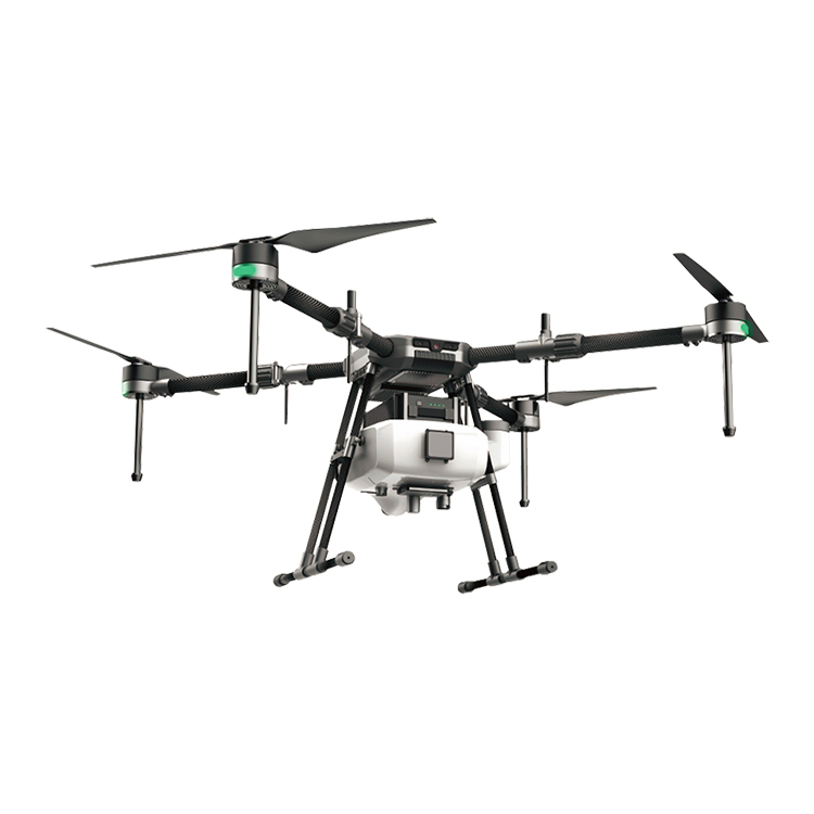
Agriculture spraying drone can replace the traditional pesticide sprayer and it's speed is 40times of the traditional sprayer. It will save 90% water and 30%-40% pesticide. Small droplet diameter make the pesticide more well-distribute and improve the effect. At the same time, it will make the people faraway from the pesticide and reduce the pesticide remain of the crop.
Contact: Fly Dragon Drone Tech.
Email: frank at dronefromchina.com
Add: NO. 9 Dayu Road PiDu distric, ChengDu 611730, China