

Figure 1
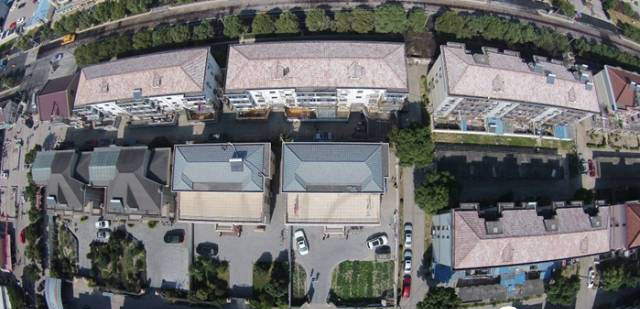
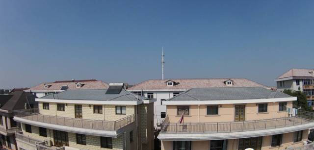
Figure 2.
As shown in the figure, due to the large roof, the picture obtained at a height of 50 meters has large distortion, which is very unfavorable for surveying and mapping. Therefore, it is necessary to fly the aircraft to an altitude of 150 meters to obtain the aerial image of Figure 2.Since the top view of the roof is the projection distance, it is also necessary to know the inclination of the roof, which can be obtained by photographing the roof from the side.


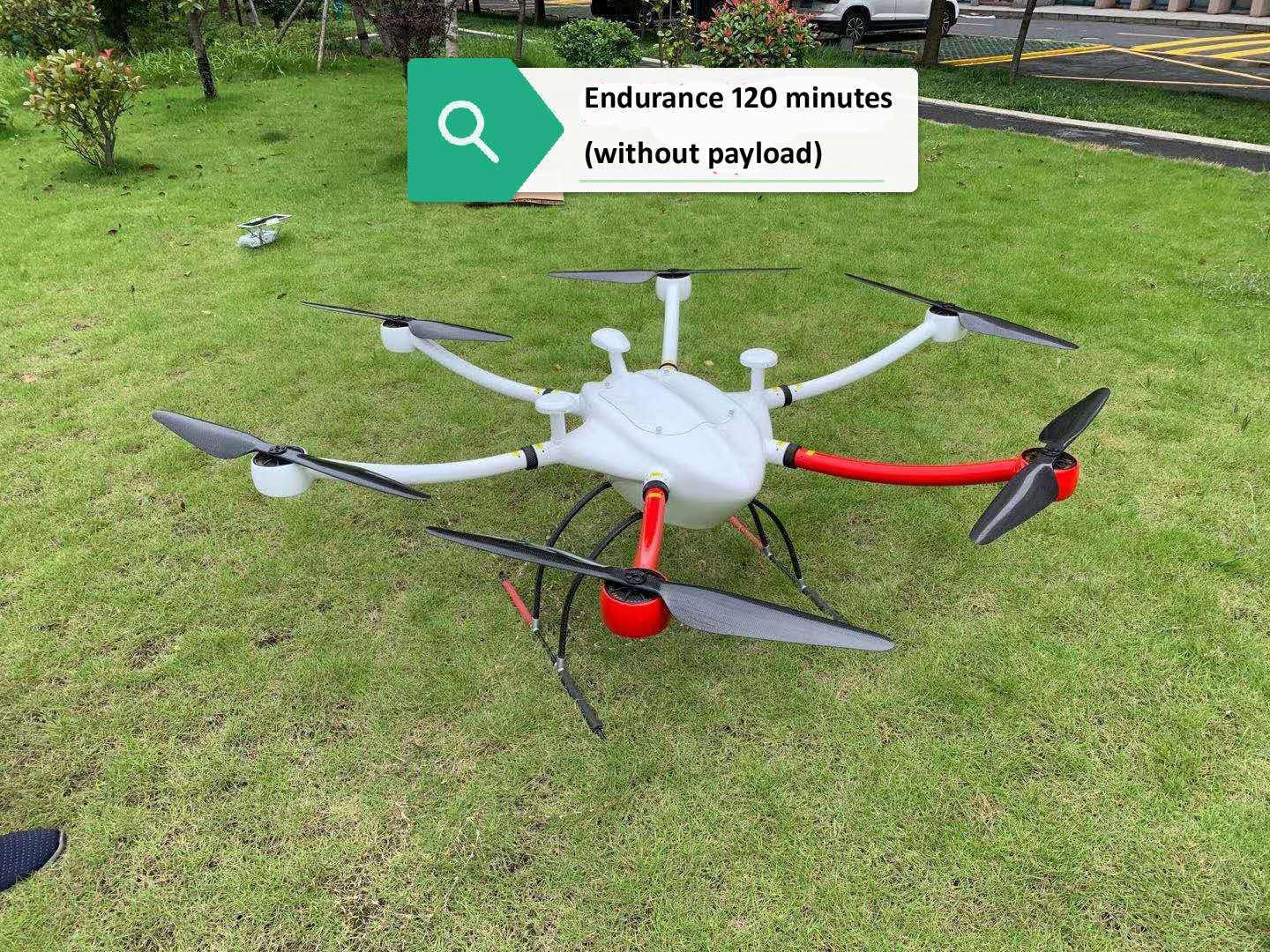
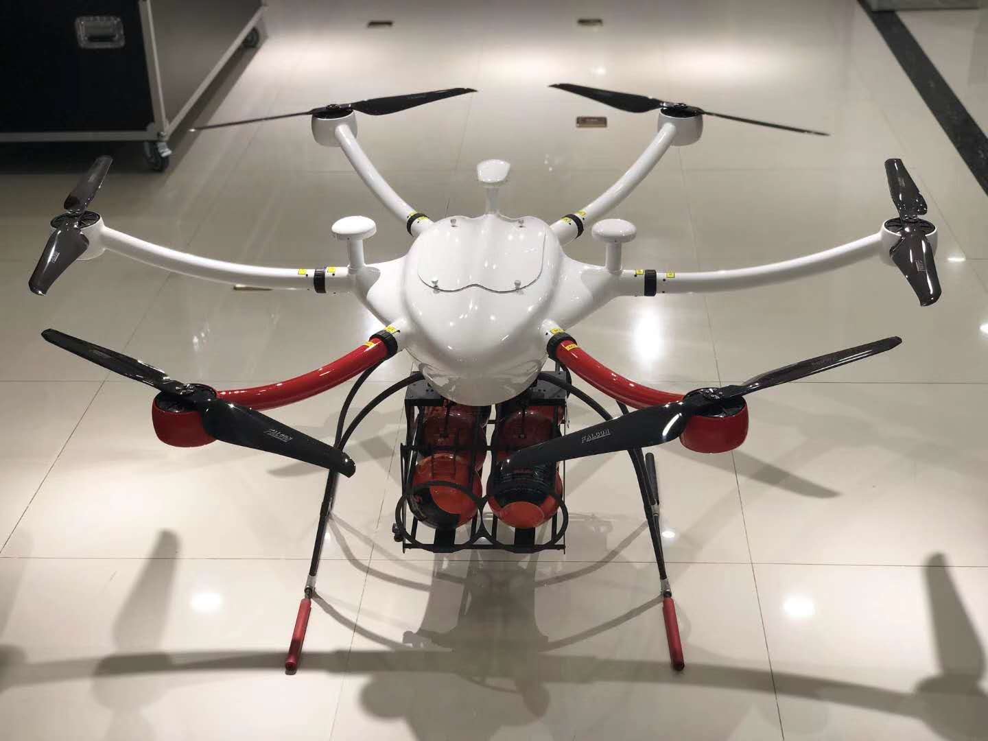
FlyDragon FD1660 is a long flight time six axis carbon fiber drone , FlyDragon FD1660 is made of carbon fiber material which features light weight and high strength, the canopy of FD1660 is made of glass fiber so that the GPS signal won’t be blocked. The closed fuselage structure can protect FD1660 from the rain and dust, and also protect other load equipments like flight control and battery.
FD1660 can be applied in many fields like aerial photography, emergency rescue, reconnaissance mission, power line inspection, remote sensing survey and mapping etc.
We suuply drone frame, PNP or RTF
Specifications:
Aircraft Type: Hexacopter
Wheelbase: 1660mm
Airframe Material: Carbon Fiber And Composite Materials
Package Size: 400*730*930mm
Drone frame Weight : 2.7kg
Max. Take-Off Weight:26kg
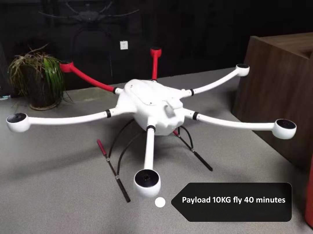
Max. Payload: 12kg
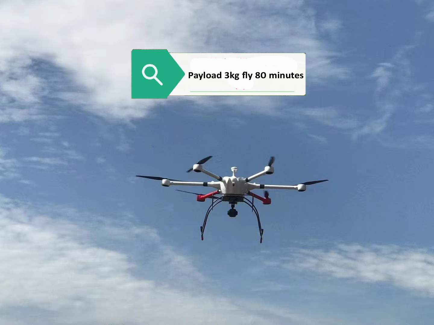
Flight time: 120minutes(without payload)
80minutes(3KG payload)
40minutes(10KG payload)
Max. Climb Speed: 4m/s
Cruise Speed: 10m/s
Max. Flying Speed: 15m/s
Max. Altitude AMSL: 4000m
Hovering Accuracy:Vertical ±1m, Horizontal±1.5m
Max. Wind Resistance: Level 6
Operation Temperature: -20~60℃
IP Rating:IP56
drone Frame Features:
– TORAY 3K Carbon fiber material
– Light-weight, durable and stable
– Rainrproof
– Long flight time
– Detachable arm, easily portable
Contact: Fly Dragon Drone Tech.
Email: frank at dronefromchina.com
Add: NO. 9 Dayu Road PiDu distric, ChengDu 611730, China