
This resource was created to help you better understand how drones are being used in mapping and land surveying today, to provide some pointers about the mapping software out there, and to generally get you started if you’ve been considering adding mapping to your list of drone pilot skill sets.
These days drones are helping people to map large areas in a quick, cost effective manner and to provide hard data that helps expedite workflows in a variety of commercial settings.
Just a few years ago, the only way to get an aerial photogrammetric map of high accuracy and resolution was to fly the area of interest with a manned aircraft—or have access to a spy satellite! But the advancements in drone capabilities and their decreasing costs have made high quality aerial maps available for a multitude of people and industries.
Let’s take a closer look.
Want to skip around? No problem:
The construction industry also greatly benefits from drone mapping. Maps can be used to regularly update clients in the construction industry on the progress of their projects, analyze stockpiles of raw materials such as dirt and gravel, or even generate 3D models of construction sites. These maps help construction managers obtain the “big picture” and assist in strategic decision making.
Read this case study on using drone mapping to verify and compare construction site earthwork to the original site plan.
Land surveyors are an obvious beneficiary of aerial mapping. Their job is to take precise measurements on pieces of land in order to determine boundaries. The data they collect assist in the creation of maps, plots, and legal documentation. With maps as a crucial part of their job, there is no doubt that drone photogrammetry can be helpful to their profession. Surveyors can obtain a highly accurate map with photogrammetry that can easily be turned into a 3D topographic map with contour data—a process that used to be extremely tedious. With their expertise and the possession of high quality equipment like RTK GPS units, surveyors can produce extremely accurate maps for their clients, and the efficiency drones provide helps them to expedite their workflow and improve their bottom line.
A word of caution for drone service providers: Many drone mapping solutions may be capable of “survey grade” quality maps. However, we recommend that you DO NOT advertise that you can provide “survey grade” results unless you are a licensed surveyor, or working with/for one. For more information about this, reach out to your state’s land surveyors board to learn more about the laws in your area.
Read this case study on using drone mapping to create an extremely accurate topographic survey prior to the development of a subdivision in Northern Colorado.
Aerial maps are useful for aiding in the sale of land. For those considering buying large areas of real estate, an up-to-date aerial map can be of considerable value in determining if the property is right for them. If you have ever looked at a standard satellite image, you know that the detail is often lacking. Drone mapping can solve that clarity issue. A highly detailed aerial map allows for insight into the property details without requiring a client to be there in person. And with the help of a licensed land surveyor, contour lines and accurate borders can even be overlaid onto the imagery. DroneDeploy is a good software option for real estate, because of its ease of use and because it was made (in part) for this type of work—skip ahead to the software section to check it out.
Read this case study on how an aerial services company in Edmonton, Canada used a drone to make a 3D recreation of a high end property for potential real estate clients.
Watch this video to see the 3D map referenced in the case study linked above:
One industry that is already embracing mapping by drone is the mining industry. Up-to-date and detailed maps are used to manage stockpiles, water drainage, erosion detection, and pit and dump management among a host of other uses. Constantly updated maps can give managers better situational awareness that can assist in decision making.
Read this case study on how aerial maps were used to help a mining company in Canada evaluate the lifespan of mining waste in order to develop a plan for expanding the sites where they stored waste.
As you probably already know, inspection is becoming an important part of the UAS industry. Drone pilots primarily use cameras to visually inspect equipment, but photogrammetry can also assist in inspection. On a small scale, drones can help create a detailed map of a roof, and RGB and IR sensors can help to detect areas with leaks or poor insulation coverage. On a bigger scale, for example, the energy industry can use aerial maps to inspect solar farms, spotting problem spots in the solar panels with the aid of infrared imagery. Raptor Maps or DroneMapper are good software options to consider for inspection work—skip ahead to the software section to check them out.
Read this case study on how drones were used to inspect the facade of a century-old building called the Palace of Justice in Messina, Italy by creating a vertical surface orthomosaic.
The industry with the most potential for drone mapping is agriculture. Currently, agriculture is forecasted to be the largest use case overall for UAS. Maps give farmers the power to quickly analyze their crops and provide crucial data to guide decision making. Using NDVI imagery, a farmer with proper training can determine the health of his field and make important decisions in real time. Instead of walking the whole crop or traversing the field with a tractor, a drone can semi-autonomously produce a map and point out areas of trouble. This means that those in agriculture can save time, increase crop yield, and ultimately, improve their bottom line. Some major drone companies that are focusing on agriculture include DroneDeploy with their Field Scanner application, Precision Hawk’s Precision Mapper, and Pix4D’s PIX4DAG software—skip ahead to the software section to learn more.
Read these case studies on how farmers are saving money with drone mapping, including a soybean farmer who located a bur cucumber infestation via aerial maps and avoided further contamination, thus saving $5,000; and a corn farmer who assessed crop damage from a hailstorm and saved about $5,500 by reallocating resources using the data provided.
Drone mapping can also be helpful to the forestry industry. With detailed maps, illegal logging can be detected and tracked, tree count can be determined, and the health of the forest can be monitored. Using NDVI imagery, areas of dry vegetation can be monitored, which can assist with forest fire prevention. Maps can also help identify dead trees, revealing whether a disease might be affecting the forest. The list goes on and on.
Read this case study to learn how drone mapping was used to create an accurate assessment of the timber quality of a forest in Ireland, and save a buyer about $178,000 on their purchasing price.
When disaster strikes, quick and accurate information is vital for emergency management to effectively respond, especially when the disaster covers a large area. Using drone photogrammetry, officials can determine the most damaged areas of a disaster (think flood or hurricane). With this data, they can effectively distribute their resources for a timely response. In 2017 we’ve seen drones at work in disaster relief during Hurricane Harvey, Hurricane Irma, and others, with drones being used in search and rescue work, and non-profit organizations using DroneDeploy’s software to create detailed maps for emergency management in the Houston, Texas area and elsewhere.
Read this case study to learn how aerial maps helped responders identify dangers, find victims, and assess structural damage following a massive landslide in the Putumaya region of Columbia.
Now that we’ve covered use cases, let’s look at key terminology in mapping.
If you scan down the page a little, you’ll see that there is a lot of vocabulary here—we recommend bookmarking this page and using it as a resource.

Image source
Photogrammetry—The science of taking measurements from photographs, usually those taken from the air.
Orthomosaic—An aerial image corrected for topographic relief, camera tilt, and distortions in camera optic so that the scale of the image is uniform throughout.
RGB Camera—This is the traditional type of camera used in mapping. It takes a sample of Red, Green, and Blue spectrums of light to create the image.
NDVI—Also known as Normalized Difference Vegetation Index, which is a derived image (usually from a modified RGB or near IR sensor). NDVI takes the reflective light from the plant and ranks it on a scale from a -1 to +1 value. When there is a higher amount of reflective light from the plant, NDVI then correlates with a healthier plant, as the chlorophyll in the plant is what the light reflects off (plants that are not healthy have a lack of chlorophyll, and therefore reflect less light). NDVI is a valuable tool for those in agriculture and can be used to analyze crop health. Although NDVI is useful, it requires a certain degree of ground truth and proper analysis to be helpful to the end user. A standard NDVI map is typically not a helpful deliverable to the end user, but rather a tool for those who specialize in crop monitoring.
GCP—Also know as a Ground Control Point, which is a physical marker on the ground that is used to keep your map geographically accurate. The location of a GCP is noted with an RTK (Real Time Kinematic) GPS (or other GNSS system) coordinate. This is a very accurate coordinate and allows your whole map to be aligned properly with the surrounding geographical area. Essentially, it makes sure that one point of the image is aligned with the precise GPS coordinate on the earth. This is very important if your map is going to be compared to an older map data, overlaid over other remote imagery, or relied upon for survey-accurate results.
Near Infrared—A spectrum of light (electromagnetic radiation) that is slightly above the wavelength of visible light. NIR light reflected off a plant can be an indicator of how healthy it is. Special NIR, multispectral, or modified RGB cameras are needed to obtain this data.
Infrared—IR is electromagnetic radiation or light with shorter wavelength (higher frequency) than near infrared. The benefits of IR is that it can detect heat.
Thermography—Thermography is imagery taken of the infrared spectrum of light. This imagery shows areas of heat in an object and is often used in industrial applications. The demand for thermographic work seems to be growing, and presents a new way for drone pilots to earn money.
RTK—Also know as Real Time Kinematic satellite navigation, this is a centimeter-accurate technique of obtaining GPS (or any GNSS) data. Essentially, the RTK receiver analyzes the GPS radio signal to calculate this data. RTK is a big deal—an on board RTK receiver on a drone can negate the need for GCPs.
Point Cloud—A point cloud is the collection of points or coordinates on an object’s surface. This collection of points can be used to create a 3D model of an area. Point Clouds are often derived from photogrammetric and LIDAR data.
Relative Accuracy—In terms of mapping, relative accuracy refers to how accurate a point on a map is to other points on the same map. This means that if two points on a map are X cm apart on the map, they should be X cm apart in the real world.
Absolute Accuracy—Absolute Accuracy refers to the accuracy of a point related to the coordinates in the real world. Absolute Accuracy means that a point on a map should match its actual GPS coordinates.
Resolution—Resolution is the level of detail on a map. This is often measured in CM/Pixel, which means that for every pixel, X amount of CM will be represented on the map.
Now that we’ve covered use cases and key terminology, let’s look at the different mapping software options out there.
It’s important to note that this list does not include every mapping software on the market. A growing number of companies are getting into mapping software as the drone industry grows, and this list is not meant to be exhaustive.
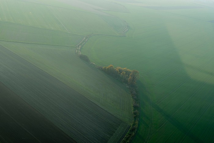
Image source
Contact: Fly Dragon Drone Tech.
Email: frank at dronefromchina.com
Add: NO. 9 Dayu Road PiDu distric, ChengDu 611730, China