UAV For Aerial Survey and mapping

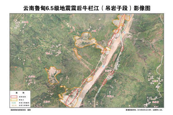
With the development of drone and digital camera technology, the digital aerial photography technology based on the drone platform has shown its unique advantages. Drone aerial photography can be widely used in major engineering construction, disaster emergency response and processing, land inspection, Resources development, especially in basic surveying and mapping, land resource survey and monitoring, dynamic monitoring of land use, digital city construction and emergency disaster relief survey data acquisition, etc.

Advantages of UAV aerial survey
(1) Fast aerial survey response capability
UAV aerial surveys usually fly at low altitudes. Airspace applications are convenient and are less affected by climatic conditions. The requirements on the take-off and landing sites are relatively small. It is not necessary to consider the pilot ’s flight safety when acquiring aerial images, and the requirements for geographic airspace and meteorological conditions when acquiring data are low. It can solve the regional monitoring function that cannot be achieved by manual detection. Every day can obtain aerial survey results of tens to 200 square kilometers.

(2 high timeliness and cost performance
Traditional high-resolution satellite remote sensing data will generally face two problems. The first is the poor timeliness of archived data. The second is that the latest images can be obtained by programming and shooting, but it is generally longer and the timeliness is relatively low. Drone aerial photography can solve this problem very well. The working group can start at any time and shoot at any time. Compared with satellite and man-machine mapping, it can be completed quickly in a short period of time, providing users with the desired results in time, and at a price Advantage.
(3) The monitoring area is limited
Because of the complex terrain and climate, many areas are affected by snow, clouds and other factors all year round, which leads to certain restrictions on the collection of satellite remote sensing data. If the flying height of a traditional large aircraft is greater than 5000m, it will be affected by the clouds and hinder the quality of the mapping. There is also a certain danger, and there are also border defense problems in the border areas. The unmanned small aircraft solves these problems very well. Without being restricted by aerial altitude, the imaging quality and accuracy are much higher than aerial photography of large aircraft.

(4) Professional machine-ground system
UAV system successfully breaks through the bottleneck of accuracy control of traditional UAV aerial survey operations, breaks through the long-distance, long-endurance, and real-time data transmission of UAVs, and can quickly obtain low-resolution 0.05-0.5m high-resolution images. An example of the 1: 500 topographic map obtained by man-machine aerial survey, which satisfies the mapping precision requirements of 1: 1000 and 1: 2000.
(5) The ability to quickly acquire and model surface data
The digital camera, digital color aerial camera and other equipment carried by the system can quickly obtain surface information, obtain ultra-high-resolution digital images and high-precision positioning data, and generate DEM, 3D orthophoto maps, 3D landscape models, 3D surface models, etc. Dimensional and three-dimensional visualization data facilitates the development and application of application systems in various environments.

2 Hours Endurance VTOL For 3D Survey Mapping
320 VTOL
1.
Not need run-way.
2.
Max payload 1-5kg (battery included).
3.
Flight time 2.5-4hours.
4.
Control distance3-100km.
5.
Cruise speed 100-120Km/H
6.
Flight altitude Maximum
4500m
7.
OEM/ODM is accepted
Used for monitor,
inspection, survey, photography, mapping etc.


