
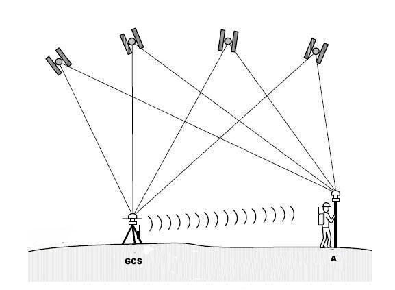
UAVs for surveying and mapping use RTK differential positioning system (which can achieve centimeter-level positioning), which is also to speed up operation efficiency. According to reports, if ordinary GPS positioning is used, in order to correct the error, it is necessary to send someone to deploy several image control points on the spot. However, if RTK is used, it is basically not necessary or only a small number of image control points are needed.
Since the introduction of RTK into the UAV field, everyone has known that it can improve the positioning accuracy of UAVs and reduce flight errors. Due to the multi-path effect of satellite signals and the refraction and reflection of satellite signals in the atmosphere, when windbreaks or weather conditions occur around farmland, the positioning accuracy of satellites will be reduced, resulting in unmanned aerial vehicles in operation.
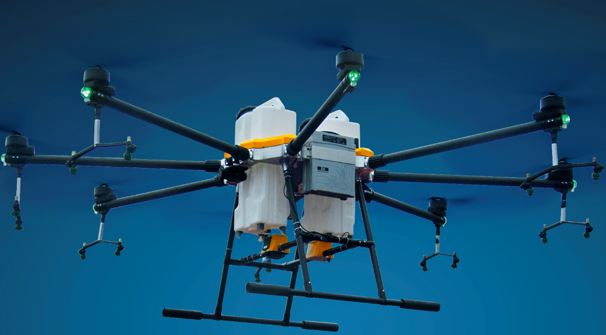
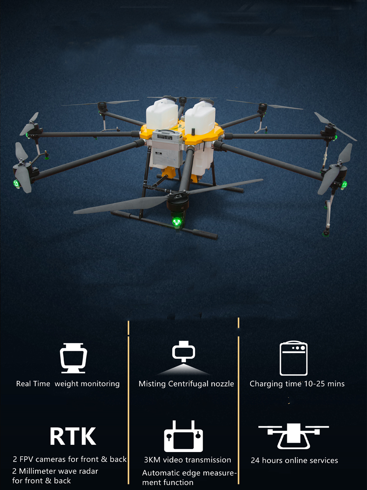
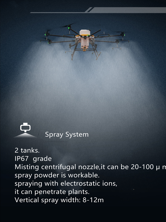
FD-8R-60L drone sprayer is Flydragon UAV company's new agriculture drone for 2021, foldable design easy to delivery FD-8R-60L drone sprayer max takeoff weight is 90KG, payload 60L, flight time is 20 minutes, effective working area is 6 acres each flight with 2 pieces 14S 30000mah
FD-8R-60L Drone Sprayer with RTK system
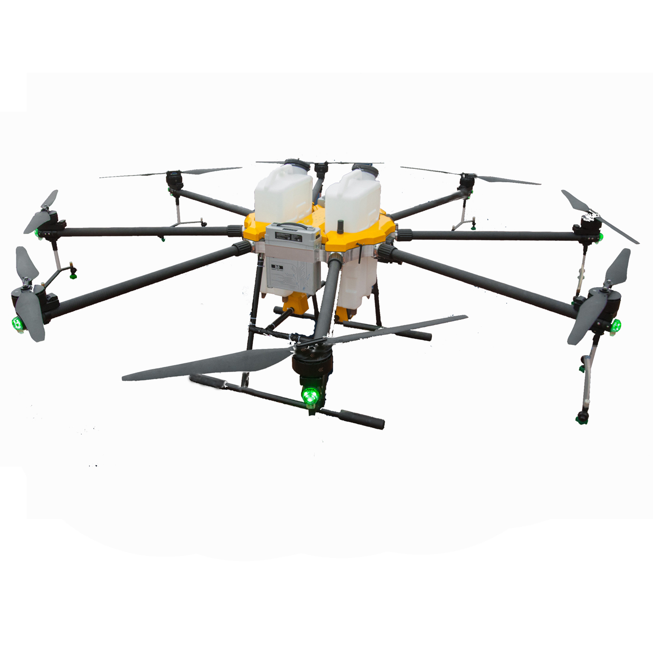
FD-8R-60L Drone Sprayer
Contact: Fly Dragon Drone Tech.
Email: frank at dronefromchina.com
Add: NO. 9 Dayu Road PiDu distric, ChengDu 611730, China