

Geologically, bare earth models are very useful. Whether it's floods or landslides, soil erosion or glacier attack, they leave their tracks on the terrain. Although they will be covered with dense vegetation, they cannot escape the "eyes" of drone lidar.
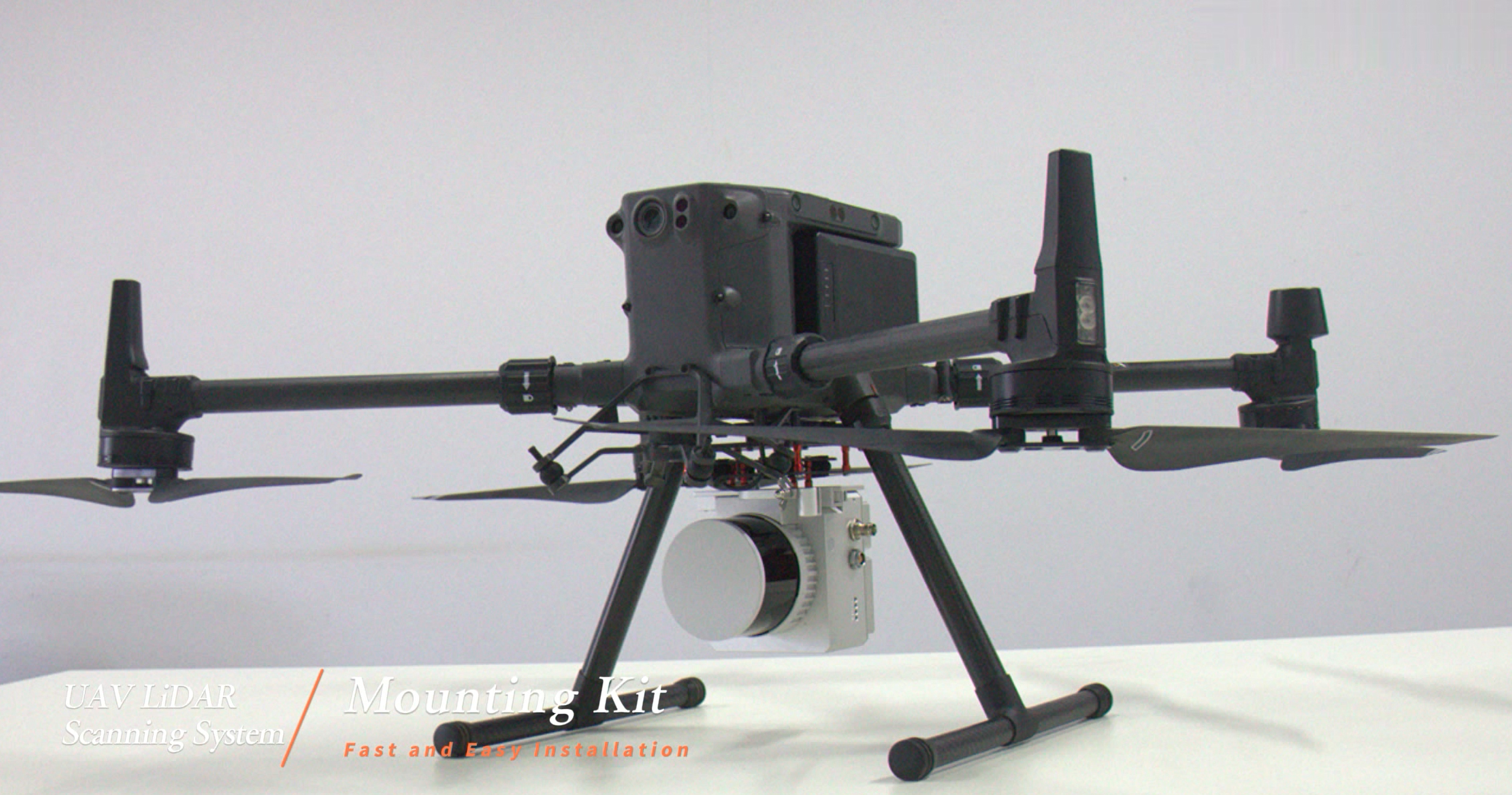
Usually, people use aerial photography to investigate landslides. But this is easily affected by dense vegetation. The images captured by lidar can clearly reflect steep slopes, depressions and landslides, so geological experts can quickly determine the location of landslides. In fact, FDG-130X integrated 32-line mechanical laser, dual echoes, has good penetration, high operating efficiency, small size, light weight, perfectly suitable for various mainstream drones on the market, 360° field of view The angle can meet the use of both airborne and vehicle-mounted, and is widely used in terrain mapping, power channel inspection, digital city and other industries. It is a high-precision point cloud collection tool.
Before lidar was widely used, geologists used aerial photographs, topographic maps and fieldwork to classify landslides. This approach is problematic in much of Washington state because lush vegetation often masks actual geographic features, making field inspections difficult.
The biggest disadvantage of general field observation is that blind faults that are not exposed on the surface cannot be observed. Blind faults are faults that have not yet developed to the surface, but have been squeezed by stress under the ground. Because geologists cannot observe the outcrop from the surface, they cannot confirm the exact location of the fault. Although blind faults may cause some phenomena such as micro-uplifts, anticline folds, etc. on the surface, they are confused with uplifts and folds produced by other reasons, so the study of blind faults can only rely on its own limitations. Scientific instrument measurement. Although the blind fault has not developed to the ground, the blind fault with the ability to cause earthquakes is not necessarily less powerful than the faults that can be found on the surface; if the blind fault suddenly triggers an earthquake, it may bring attention to the people living on it. Unexpected damage.
Lidar has been a great help for geologists looking for hidden fault zones. For example, Washington has several large glacier peaks and glacier mountains. Lidar can be used to monitor the growth or decline of these glaciers. Repeated monitoring of the same area documents the effects of climate change or geological activity. In addition, geologists can use lidar to identify moraine and glacier channels to explore the history of glaciers during the last ice age.

FDG-130X drone lidar system integrates 26M camera and 32-line mechanical laser, dual echoes, good penetration, high operating efficiency, small size, light weight, perfect fit for various mainstream drones on the market, 360 field of view It can meet both airborne and vehicle-mounted use, and is widely used in terrain mapping, power channel inspection, digital city and other industries.
Shooting Mode: Isochronous/Isometric


Contact: Fly Dragon Drone Tech.
Email: frank at dronefromchina.com
Add: NO. 9 Dayu Road PiDu distric, ChengDu 611730, China